- TOP >
- SHIKISAI GeoTIFF
SHIKISAI GeoTIFF
G-Portal GCOM-C "SHIKISAI" Standard Products
The following standard products are available from G-Portal for GCOM-C "SHIKISAI" data.
In addition, datasets for global environmental change research, including GCOM-C "SHIKISAI" data, are available at the JASMES site.
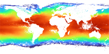
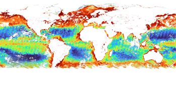
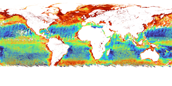
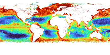
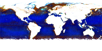
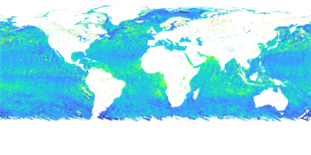
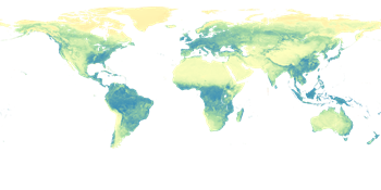
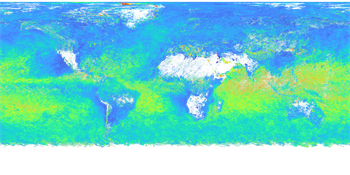
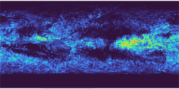
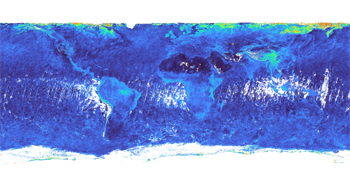
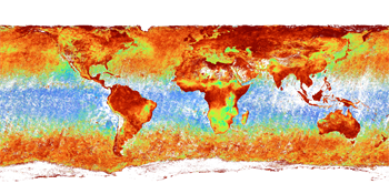
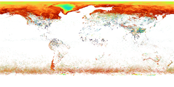
<Ocean>
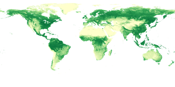
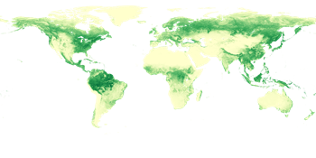
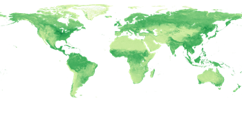
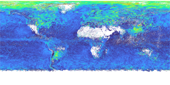
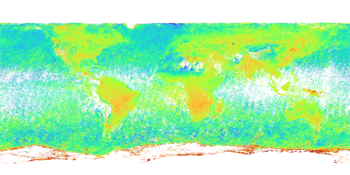
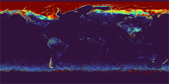
<Land>
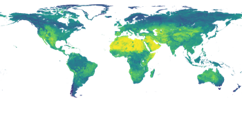
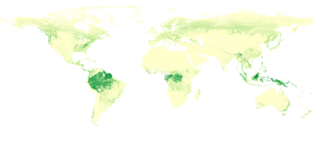
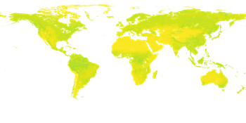
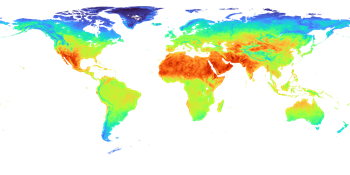

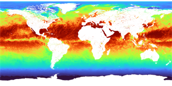
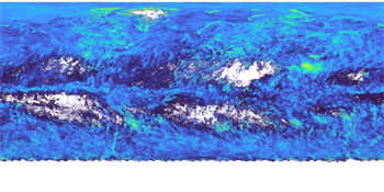
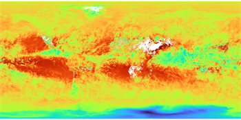
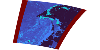
<Atmosphere>


We provide conversion tools and data for using GeoTIFF data from GCOM-C "SHIKISAI."
| Tools/provided sites | |
|---|---|
SGLI Map projection & GeoTIFF conversion Tool (Click on the tool name to go to the download page) Platform:Windows、Linux |
HDF5 format data obtained from G-Portal on the command line can be converted into GeoTIFF files through map projections. |
Earth Observation Data Conversion Tool (Click on the tool name to go to the download page) Platform:Windows |
HDF5 format data obtained from G-Portal using a graphical user interface can be converted into GeoTIFF files through map projection. |
JASMES (Click to go to the TOP page of JASMES Portal) |
Datasets for global environmental change research are available in netCDF, GeoTIFF and other formats. You can download GeoTIFF data with "FAI monitor" and "Ibay Monitor". You can download map-projected netCDF data around Japan with "SGLI Near-realtime Monitor" and around Japan and the globe with "SGLI Standard Data." User registration is required to download the data, but no registration is required to view it. |
G-Portal Processing Request (Click to go to G-Portal TOP page) |
A G-Portal feature allows you to produce GeoTIFF files from the "Processing" button in the search results. User registration is required to download the data and make processing requests. |
JASMES sites using SHIKISAI data are summarized in "Data Acquisition" in the menu above.
This site explains how to use the "SGLI Map projection & GeoTIFF Conversion Tool" for map projected GeoTIFF conversion of Level-1B, Level-2, and Level-2 statistic products obtained from G-Portal, and how to use "gdal(QGIS)" for GeoTIFF conversion of Level-3 products.
Click on the image of each field above to link to the description page.
For Level-1B GeoTIFF conversion, please click here for a link.
<G-Portal SHIKISAI FTP directory>
SHIKISAI data can also be obtained from G-Portal's FTP site via an FTP client.
G-Portal's FTP directory structure is as follows.
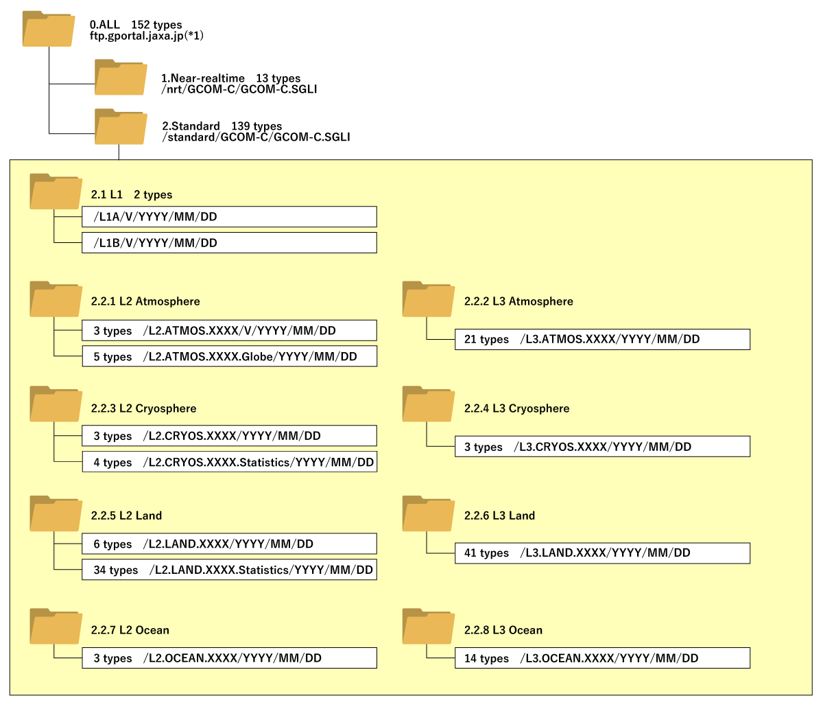
XXXX:product ID V:Product version YYYY:year MM:Month DD:day
※1 FTP and SFTP connections are the same at ftp.gportal.jaxa.jp.
FTP (protocol: FTP, port number: 21, registered account, password: anonymous)
SFTP (protocol: SFTP, port number: 2051, registered account, registered password)
※2 "Special User" Registration is required to access the "Near-realtime" folder.
<Resolution and statistical period per product>
| Non-Global processing | Global processing | ||||
|---|---|---|---|---|---|
| Level2 | L2 Statistics | Level-2 Global | Level-3 (Statistics) | ||
| Tile or Scene | Tile | Global EQA (A) | EQAbin (X) EQRmap (D) PS (N or S) |
||
| Atmosphere (types) | 29 | 3 |
--- |
5 |
21 |
| Cryosphere (types) | 10 | 3 |
4 |
--- |
3 |
| Land (types) | 81 | 6 |
34 |
--- |
41 |
| Ocean (types) | 17 | 3 |
--- |
--- |
14 |
| Total (types) | 137 | 15 |
38 |
5 |
79 |
| Resolution | Q (250m) H (500m) K (1km) |
Q (250m) K (1km) -- |
F (1/24° : 4.6km) -- - |
F (1/24° : 4.6km) C (1/12° : 9.3km) -- |
|
| Statistics period | -- -- -- |
-- 08D (8 days), 01M (monthly) |
01D (daily) -- -- |
01D (daily), 08D (8 days), 01M (monthly) |
|
<SGLI projection coordinate system>
| 1.1 Sensor hardware coordinate | 1.1.0.1 Scene | |
|---|---|---|
| 1.2 Map projection coordinate | 1.2.1 Equal Area Coordinate (EQA) | 1.2.1.1 Tile |
| 1.2.1.2 Global EQA | ||
| 1.2.1.3 Global EQA (bin) (1D) |
||
| 1.2.2 Equal Lat/Lon Coodinate (EQR) | 1.2.2.1 Global EQR (map) | |
| 1.2.3 Polar Stereo (PS) | 1.2.3.1 PS (N) | |
| 1.2.3.2 PS (S) |